


(Additions have been made below in February 2011.)
Following this event on Saturday 27 November (click on yellow above, for details) you are still welcome to comment, on the following subjects.
 |
| (For all these photos, click to enlarge) In the background is the Strata 'Razor' tower. |
FIRSTLY, there was a site visit to Walworth Road in south London on 13 November.

- high quality materials
- additional space for pedestrians, including additional street crossings
- altered parking and loading zones
- an improved overall setting for each area.

Feel free to visit those locations anyway (or just look at the pictures!) and give your opinions about whether, and where, such upgrades could apply in Harlesden, or how they could be modified.
There is a picture of The Cut on James Powney's blog.
There is a picture of The Cut on James Powney's blog.
You can also add your comments below!
SECONDLY, Brent Council and Transport for London would also like you to give feedback on the "Public Realm Scheme Design", which discusses parking and three options for the road system.
(Click here for the original 'Public Realm' design)
This document covers:
(Click here for the original 'Public Realm' design)
This document covers:
- traffic flow, parking and loading within the town centre: Brent Council has shown three options (A, B and C)
- the Controlled Parking Zone (CPZ) boundaries
- Station Road Approach: Fast Track Programme
- traffic, parking and loading within the town centre.
Please send your thoughts, ideas, comments and solutions to the Advisory Team, by Monday 22 November 2010.
On Saturday 27 November, a team looked at the Public Realm Scheme Design in detail.
Again, also add your comments below!
February 2011:
A fourth possiblity for the road system has been developed, with a small gyratory in the centre of Harlesden, using Crown Hill Road and Tavistock Road.
(Click here for the 'Small Gyratory' suggestion)
THIRDLY! There are now later posts, such as this one on street design.
To avoid comments being spread out over several posts, please leave all your comments about Harlesden Town Team and the Open Day below.
Just browsing this single item? - then view a full list of posts.


(This comment has been copied from another post)
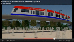
ReplyDeleteI hope this event will give us a chance to express our support for Old Oak Common station (as part of High Speed 2 and Crossrail) so we can transform our area into the best connected public transport location in the UK!
SOUTH LONDON VISIT
ReplyDeleteI think the obvious location for a first treatment like this is Station Road. It would provide a demonstration of what could be done. There might even be mistakes that could be corrected elsewhere.
I think the consideration of the "palette" of the paving and street furniture is overdone - only architects notice much of it.
"Pimple-paving" should usually be in a contrasting colour, since it is used to help partially-sighted people know where to cross.
"Corduroy-paving" is a waste of time, if it is supposed to show cyclists where they are crossing on to a "pedestrian-only" part of the pavement. They ignore it.
A "palette" COULD be used, if the whole road could be coated in, say, red. Then the pavements could also use red paving and red blocks. All these are standard colours in the trade, I think, so there is a reasonable chance it would be maintained like that. Maybe extra, empty trunking could be put in, for future utility companies to use, to avoid some road works.
A "palette" of "grey-silver" as I think James calls it, is just cheap "plain concrete" to most people.
Without necessarily slowing traffic, or reducing road capacity, I strongly think the lines of traffic should be made to SWERVE a bit - around built-out pavements at some points, and around central reservations at others.
The central reservation should be narrower than in south London, to stop parking there. It could also be a bit higher, with sloping sides - although that might be unsafe when icy).
To reduce cost, there is no need to go the full monty and have pavements and roads at the same level. The edge of the pavement could simply slope down to the road (again with the "ice" problem though).
Some diagonal coloured stripes across the whole width of the pavement and road are possible - this breaks the image that the road and the pavement are completely separate.
My second major point: We would have to make pavement-parking at some points highly anti-social - by careful use of road widths, so traffic would need to mount the (very low) central reservation to get past. There would always have to be room for three lanes in an emergency, for fire engines, and so on, to get past, but three lanes might only be possible at low speeds, because it is only just possible - and that is fine.
We should blow the budget on LED street lights. These are expensive, but will be the ONLY kind available when costs fall. Ask Transport for London about them, because they have used them on the London Overground East London Line - at Hoxton, I think. They give a different, classy look, I think. (They are like the lights at the doorways of the new London Overground trains, as well.)
On James Powney's blog: The stone cube at The Cut is a good idea. It provides a seat for the elderly, but not for drinkers, who nearly always want to drink with others. However, it would be invisible in deep snow (not often a problem, of course).
PUBLIC REALM SCHEME DESIGN
ReplyDeleteSTRATEGY
What is needed is a wide view of the WHOLE area, to devise a long-term strategy.
That means from the A40, to the North Circular, to Neasden Lane, to whatever, to Scrubs Lane.
We should see what wider traffic could be kept out of Harlesden.
For instance, we should lobby for the Scrubs Lane bridge to be repaired.
We should look at an axle-weight limit, over a wide area.
We should see what traffic could be encouraged on to the major roads, and only have the A404 Harrow Road as the "traffic we cannot avoid".
We should lobby for any "Old Oak Common station" works to JOIN Hythe Road with Old Oak Common Lane, requiring a railway bridge or a canal bridge. That would bypass Harlesden for some traffic.
GYRATORY
I do not think any "improvement should be allowed to increase traffic on the northern half of Manor Park Road.
One of the 1992(?) plans used two-way on the southern half of Manor Park Road, cutting across to the wide part of Craven Park Road, which also became two-way. That would be the "through route for the A404".
That is my favoured plan, with the road cutting across the Manor Park car park, and some demolition. The point would be to offer development on what is left of the car-park. I think there is enough room for "public
vents" on the school land, to the east of Manor Park Road, if that land was managed differently.
There is no longer a chance of taking Acton Lane and Station Road traffic BEHAND the High Street Harlesden shops to what might have been a new T-junction, because of new housing.
That traffic could now use a two-way section of High Street Harlesden, east of the Clock, to an enlarged cross-roads with Park Parade, maybe demolishing the first shop on the northern side of Park Parade to gain more room..
We would be trying to "simplify" Harlesden traffic, down to" a cross-roads of the A404".
That cross-roads would be the major road junction in Harlesden, as a necessary evil - with filter lanes, the works.
We could then consider what to do with the bits "left over". This would have to discourage taking short-cuts off that major road system, and also seeing if bus lanes or bus routes could use them.
For instance, maybe buses could travel south-bound on the northern half of Manor Park Road, with other traffic not allowed through the top-end start to that road (but could use the reat).
Also, the "unused" bit of High Street Harlesden, north of the Clock, could be by ALL southbound traffic, including buses, and only left-turn at the Clock for cars, so little would be gained by using that route. Northbound could be for buses only. Other traffic would have to go to the main cross-roads.
The idea would be to keep as many of these extra "left-over" routes for all traffic as possible, but simply make them unattractive as through-routes in practice, because nothing would be gained.
NOTE: Please have a dig at Brent House, and bring along the 1992 (?) plans on Saturday. Even bring any pre-gyratory maps!
CONTROLLED PARKING
No opinion on this.
I do like Leroy's "20-minutes" parking on the main roads - and you pay, so the attendants can police it. Could be 30-minutes, or 40 minutes, I suppose, but it should be simple - only one length of time on all the signs. Maybe the main roads should not be in any zone really - just the 20-minutes, 8am to 8pm say, then free parking, by anyone, to encourage the night-life.
STATION ROAD
Commented already, about the south London trip. As I said, Station Road would be a good Phase One for us.
CRAVEN PARK ROAD GYRATORY
ReplyDeleteI do not think COMPLETELY closing the eastern route is a good idea.
For the eastern side of the triangle:
- I previously presented a plan for there to be northbound access for 260 and 266 buses only (although only an actual bus LANE at the bottom end start of the lane). Southbound would be for any traffic from the Church Road direction that wanted to go towards down-town Harlesden.
For the western side of the triangle:
- I think there would be room for a south-bound 18 bus lane, which would prove popular with TfL.
Traffic lights would only be needed at the new main T-junction. Elsewhere could avoid them, and the expense.
Were any traffic counts taken in "October 2010"?
Is the house in the middle being saved?